
5 ways tech is helping to conserve forests
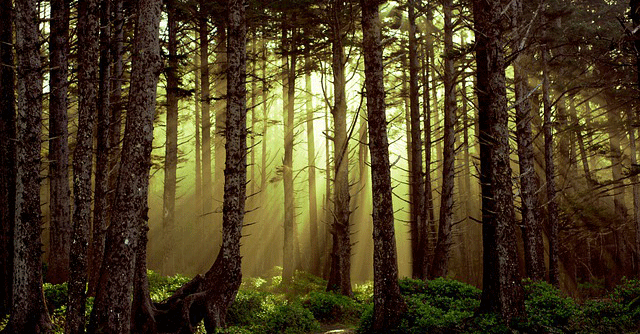
Forests are our lifelines and trees are without a doubt the best carbon capture technology in the world. Unfortunately, trees are disappearing at record rates. The pace of the loss is staggering -- the equivalent of 30 football fields disappearing every minute of every day, or 12 million hectares a year.
According to the UN's Food and Agriculture Organization (FAO), 80% of terrestrial animals, plants and insects live in them, alongside humans, more than 2.5 billion of whom depend on forests and forest products for food, water and living.
Despite a slew of counter-measures at both the national and international level, deforestation has continued largely unabated since the beginning of the century. As per Global Forest Watch estimates, in 2020 itself, the world lost 258,000 sq km (99,600 sq miles) of forest -- an area larger than the United Kingdom.
As in most cases, technology has often come to the rescue of environment if used in the most efficient way. On World Forest Day (March 21), we bring to you some tech-led initiatives that are being used to help protect the planet's forests, ecosystems, and wildlife.
AI to track wildfires and water loss
Wildfires are a danger to ecosystems, cause a loss of vegetation, and emit large amounts of air pollution whilst water loss is devastating for wildlife.
US-based company Descartes Labs has been using AI to detect and track wildfires. The company's AI software captures images in roughly every few minutes to detect whether a fire has ignited and its whereabouts. According to a 2019 article posted on CNN Business, the software has been able to detect fires faster than firefighters or civilians in affected areas.
AI also helped uncover the water crisis in those forests that are affected by wildfire, deforestation and degradation.
Bangalore-based 4th Phase Water Technologies Pvt. Ltd co-founded by renowned water scientist Dr. Krishna Madappa and Srinivasan Vitoba , has come up with Jiva, a water structuring device that erases the trauma of water and transforms it to its natural healing state is being used to revive soil in various agricultural fields across South India.
“About a third of the world's soil has already been degraded,” said Vitoba. He added, “Water restored to its original state of pure energy, elevates moisture absorption and nutrient content of the soil. This improves the soil’s ability to hold and nourish roots that grow deeper into the soil. Evaluated successfully across 100 agriculture fields in South India on various crops and livestock, the technology will be used to revive forest soil, rejuvenate lakes/water bodies etc. in the coming years.”
Big data to tackle illegal wood trade
A very effective technology to tackle illegal wood trade is by tapping into big data analytics to help flag suspicious timber imports. To address this, WWF and TRAFFIC have partnered with data scientists at Virginia Tech University. These scientists are analysing publicly available data to create a software tool and algorithms that could be further developed by law enforcement agencies and others to flag suspicious timber shipments.
“From documenting our planet’s greenness to detecting where resources are being illegally harvested, big data analyses can place detailed evidence of rapid environmental change in the hands of entities capable of management action,” said Dr. Rebecca K. Runting · Lecturer in Spatial Science at the University of Melbourne.
However, she believes, there must be a tight coupling of big data analyses and the sustainability agenda to ensure we do not run out of time and space to save our environment—and ourselves.
Satellite imagery to protect wild life
Conservation scientists have recently started using satellite imagery to keep track of elephants, in parts of Africa and Asia that are continuously on a decline.
The images come from an Earth-observation satellite that orbits 600 km (372 miles) above the planet's surface can capture up to 5,000 sq km of elephant habitat on a single clear day. Machine learning is then used to count the number of elephants visible in the satellite pictures.
Satellite imagery and machine learning can empower not only conservationists but also corporations. Google announced a partnership with consumer-packaged goods company Unilever in 2020 to help end deforestation within its enormous supply chain.
“By combining the power of cloud computing with Google Earth’s ability to map the planet by satellite imagery, we’ll be able to store and make sense of huge amounts of complex data, and gain insights into any impact on local environments and communities,” said Dave Ingram, Unilever’s chief procurement officer in a September 2020 press release.
The move, according to Ingram has helped in better detect deforestation and prioritised any areas of forests or habitats in need of urgent protection.”
Drones to plant trees
The rate of deforestation is rapidly escalating as a result of climate change, human destruction, and global food production.
Repopulating trees lost to deforestation is essential to help regulate and decrease global carbon emissions and encourage biodiversity. Drones that fire seed pods into the ground have become the fastest and most effective way to plant a large number of trees.
Last year, Canadian company Flash Forest used drone technology to plant seeds in an area where trees had burned down in a wildfire. The company plans to plant 40,000 trees a month and aims to have planted 1 billion trees by 2028.
According to data, using drones to plant trees is 10 times faster than manual plantation by humans.
Infrared Imaging to protect animals
Scientists are now using the captured thermal infrared imagery from drones to protect endangered species. These drones are capable of surveying the large areas of tough terrains and help scientists access and monitor those areas that are difficult to reach.
Thermal imaging is a method that improves the visibility of objects in a dark environment and helps protect the animals from poachers who mainly operate at night hours.
Several endangered species from Orangutans in Malaysia, the spider monkeys in Mexico, Australia’s koala population and the river dolphins in Brazil, and others on the verge of extinction have been protected in a similar way, even though there's much that is left to be done.
Next Article